Day 3 : Walton to Shield on the Wall : 17.4 miles, including walking around a fort, going the wrong bloody way, and the ¾ of a mile from the trail to the campsite.
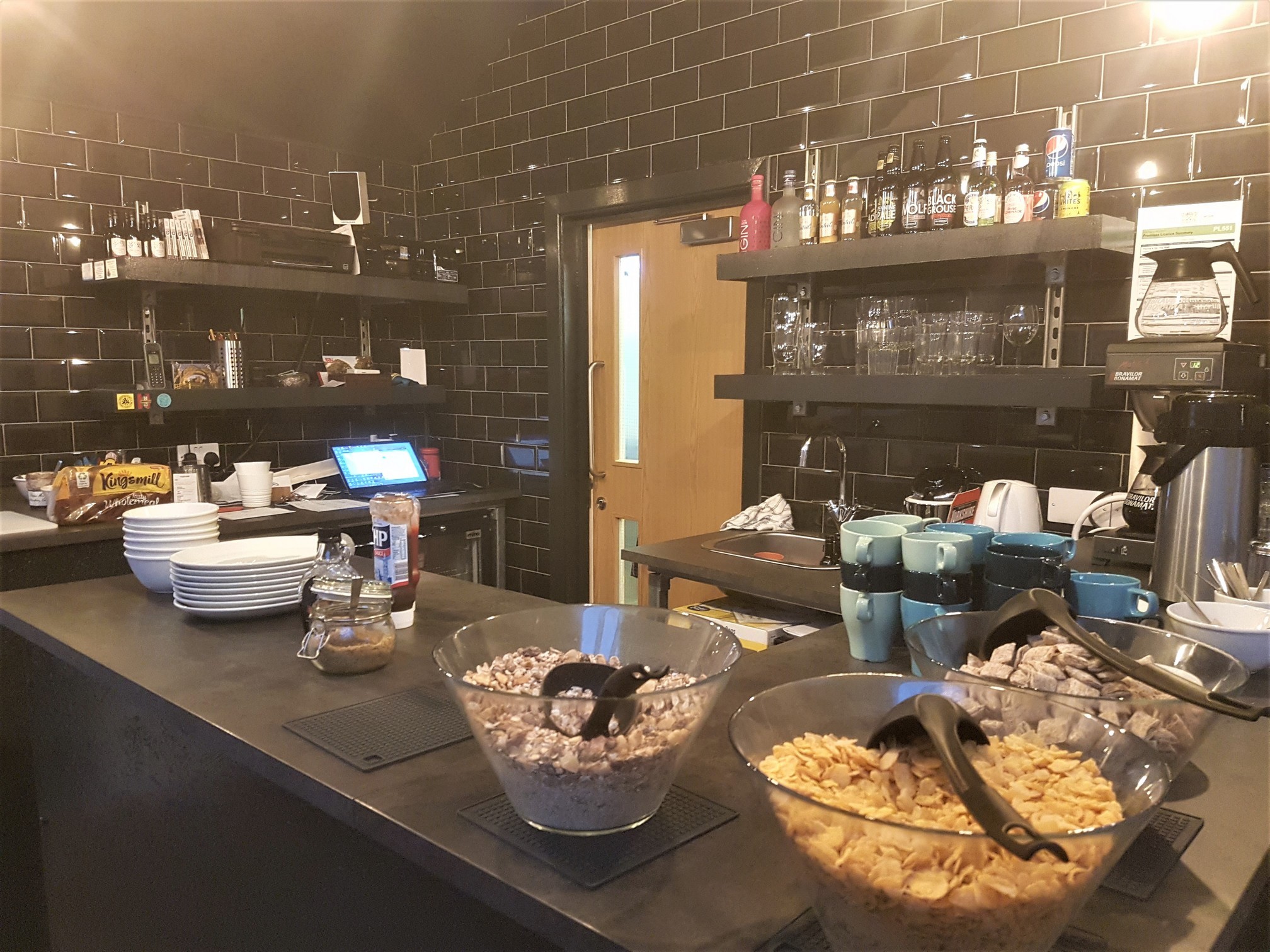
Well they do say that breakfast is the most important meal of the day (actually I think it’s just cereal companies that say that, and possibly anyone in my general vicinity when witnessing me pre-breakfast) and Florrie’s didn’t disappoint. I usually wake up hungry enough to fight a rabid dog for its food, today was no exception, and when I walked into the common area to be greeted by several different types of cereal and an array of spreads for toast I nodded approvingly. I would apply all of this to my digestive system, thank you. You can imagine my joy when the owner popped his head out of the kitchen and said, “Today’s hot option is pancakes with bacon, but I don’t think your friend can have the pancakes?” No, that she can’t, and I have an aversion to pancakes since we travelled Bali and were fed banana pancakes in vary degress of edibility for breakfast every single bastard day. Just hand me the dead pig and back away please, sir.
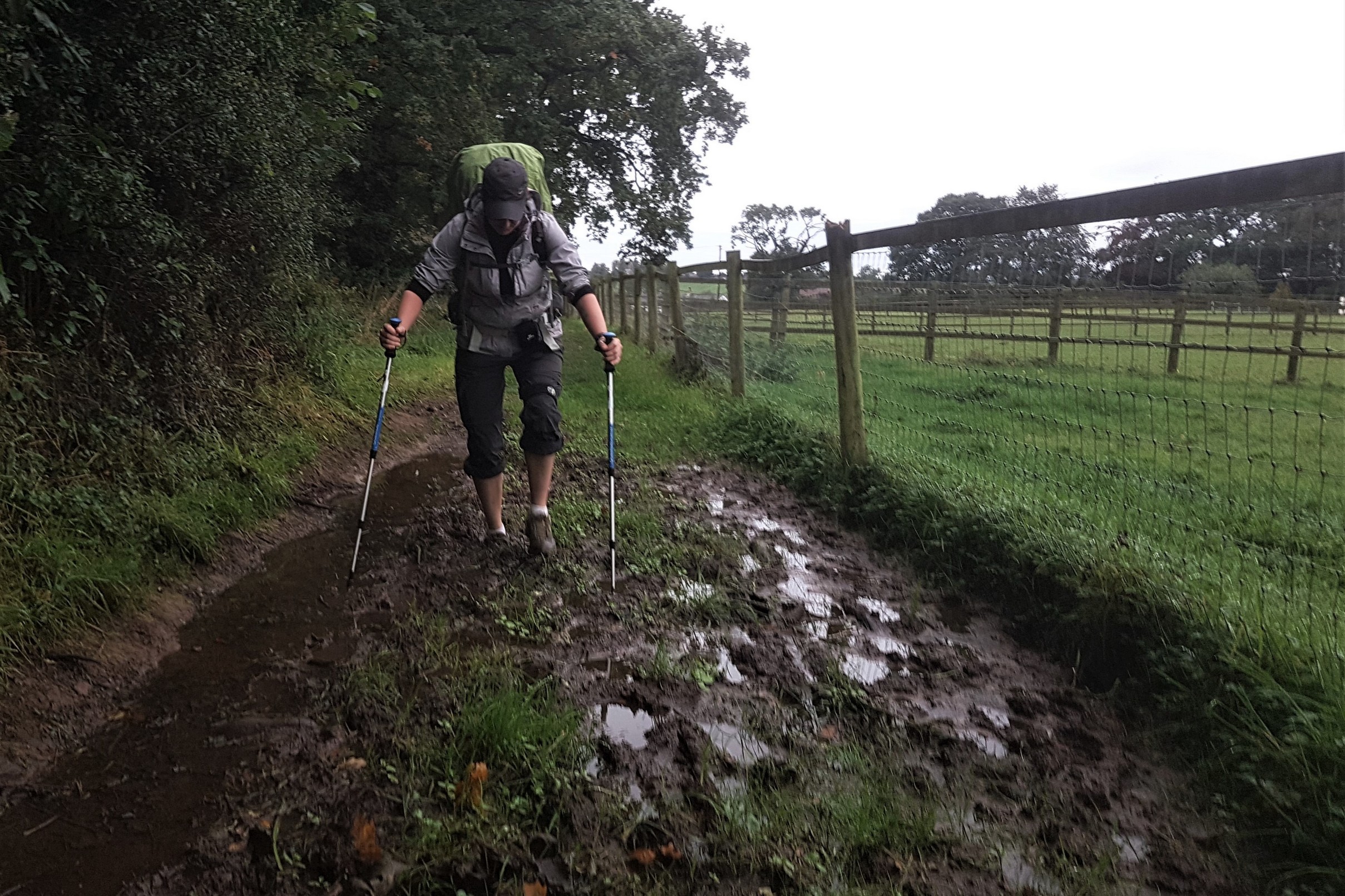
Today would be our latest start on account of the fact breakfast wasn’t served until 7.30am. The first two days we were up at 5.30am and on the trail by 7. Today it was closer to 8am by the time we were retrieving the last of our things from the drying room and getting on our way. Once again the weather forecast was bleak but it wasn’t currently raining, we’ll take that, but after the relentless pissing downpour of the previous day which started as we settled into the common area at about 3.30pm and literally hadn’t stopped by the time we went to bed, the trail had pretty much turned to mud and ponds. Tarrant’s shoes weren’t at all waterproof and my left Merrell was leaking like the Titanic despite being brand new. Great.
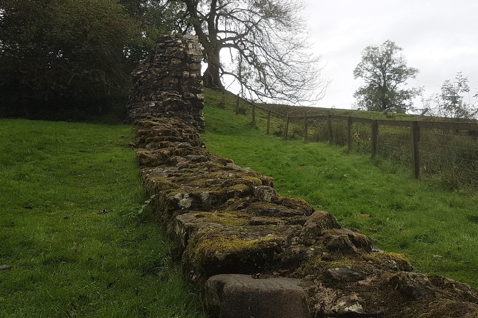
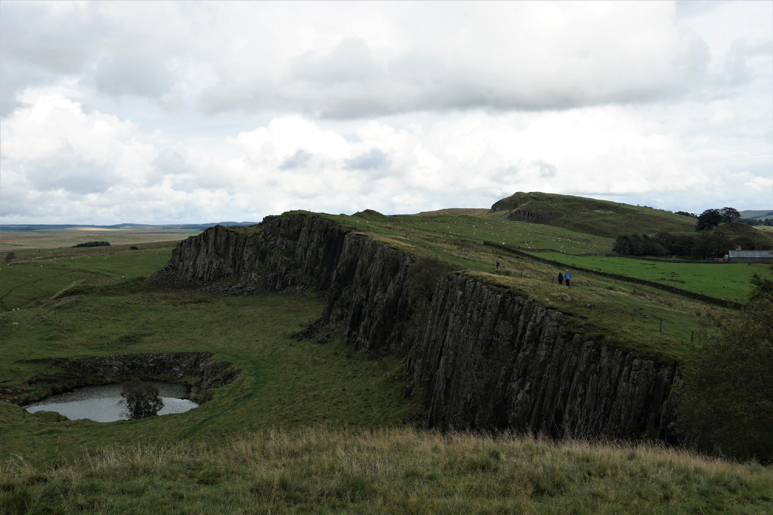
We picked our way through the slush for about an hour and a half until we finally came to our first bit of actual wall-shaped wall at Hare’s Hill. I mean, it’s wall-ish shaped anyway. It’s not church-shaped. Apparently it’s the tallest section of intact wall and by rights it shouldn’t even still be intact as most the stone around these parts was robbed in the 12th and 13th centuries to build the nearby Lanercost Priory. One theory is that it was used as part of a medieval farm building around the time of the stone theft so it was left alone.
Our next bit of wall came to us in the form of Turret 52a, an observation tower at Banks East, and we arrived just as it was being swarmed by a bus load of American tourists. The tour leader must have spotted us with our backpacks and hiking poles and sweaty complexions, and she bee-lined straight for us. “Hey, are you guys walking the wall?” We replied that we were and told her it was our third day and we’d only just started to see some actual wall. She turned to her group and announced our presence with, “Guys, they’re walking the wall, this is their third day, and this is the first bit of wall they’ve seen!” Suddenly the large chunk of ancient history was a bit less interesting to the gathered masses and we fielded questions about the hike from the group. A couple of people even asked for photos. We’re going to be on some random American’s Facebook album. Hashtag celebrity life.
We waited for them all to get their shots in before we took a few of our own and brushed up on exactly what we were gawping at. Turrets, apparently, were watchtowers spaced out two to every Roman mile, between the larger Milecastles, where a handful of soldiers would live or shelter whilst guarding the wall. This particular section of wall was originally built from turf before being replaced with stone, and this Turret started life as a stone tower within the turf wall. Over time some Turrets were abandoned or adapted according to the needs of the military at the time, and this one remained in use into the fourth century. They have discovered evidence of hearths in the Turrets used for warmth and cooking which is pretty neccessary in the north of England if you wanted to get through the next 4.6 seconds without freezing to death.

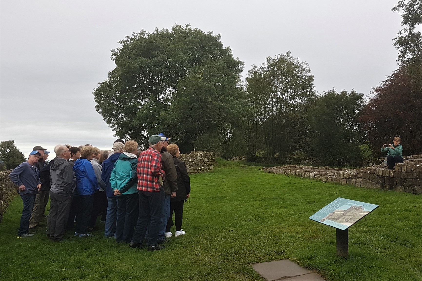
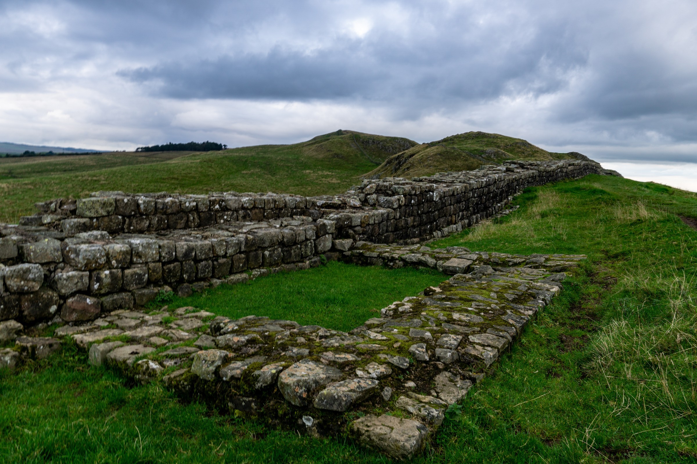
We were by a road but mercifully on a trail rather than the tarmac as we continued onwards, past the remains of a signal tower that pre-dates the wall, past a couple more Turrets to Birdoswald Fort. Might as well have a look as we’re here then, but we were very conscious of how far we still had to walk, and it had started to rain. I mean, this is the north, you probably couldn’t call it rain just yet, more a bit of gentle sky-spit and it soon eased off. Once inside the visitors centre we were bombarded with far too many facts and figures to take in properly.
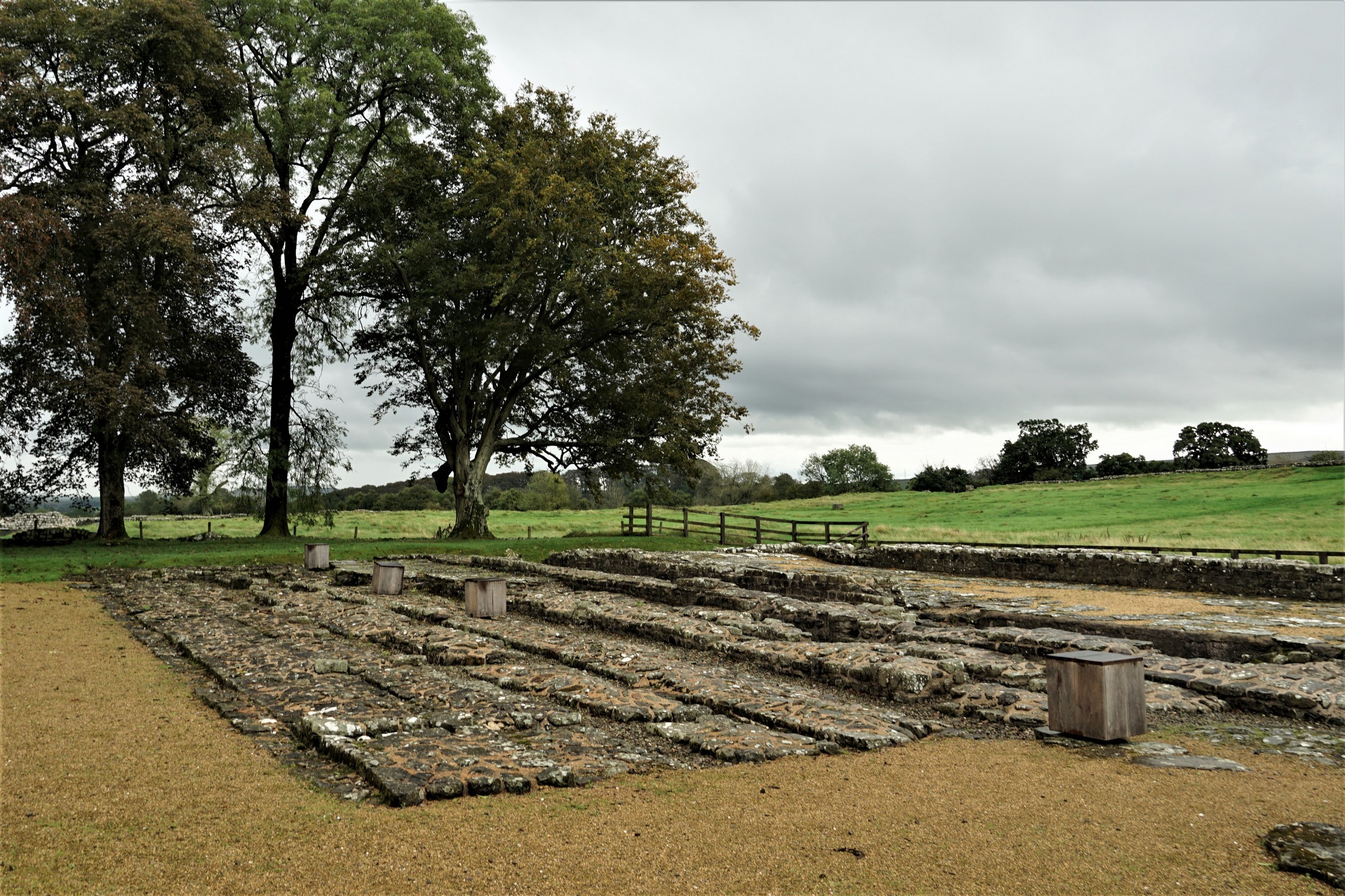
As we’d already learned, this section of the wall used to be made from turf but this was eventually demolished to make way for the stone wall, and it was decided that as well as Milecastles and Turrets there should also be sod off great big forts such as this one to house larger garrisons. Well, an emperor does have the right to change his mind but a Turret was pulled down to make way for the fort. I’d be well pissed off if I’d just built a Turret and they decided they wanted a fort instead.
The wall, it turned out, wasn’t just a wall either. They dug a big ditch to the north too, and south of the wall they built a Vallum, which is a particularly massive ditch with a huge mound on each bank. This pretty much runs the whole length of the wall. We also learned that they didn’t go the easy route when they hit the hilly middle part of the country either, they just carried on building right up and down the crags. It’s amazing what leaders will make their workers do when they don’t have to factor in the cost of labour, or any manner of health and safety for that matter. We also realised as we watched the video demonstrating what the wall would have looked like that we would, at some point, possibly today, have to drag ourselves up and down these hills and just kind of hoped they weren’t as steep as the mini-movie made out.

After a cursory glance around the ruins themselves we picked up our bags and carried on to our first Milecastle at Harrow’s Scar. The ruins themselves just look like bigger Turrets but Milecastles, positioned every Roman mile (1.48 kms, fact fans) because of course they are, are basically fortified gateways. You need holes in the wall so soldiers can patrol both sides, and Milecastles made sure that only authorised humans got through these holes.

The next epic piece of architecture we came across was a bridge, because of course the wall crossed rivers, and if the artist’s impressions are any manner of accurate, it would have been spectacular in its day. This was the third bridge built on this site after the first one was destroyed by a flood and the second one was just replaced by a better bridge. It’s nowhere near the river now, mind. The river itself has changed course over the years. It’s hard to get in into my head how long has passed since this was built because in my mind it has no right to be still standing in any form. This bridge is third century. Third! How is this even possible?
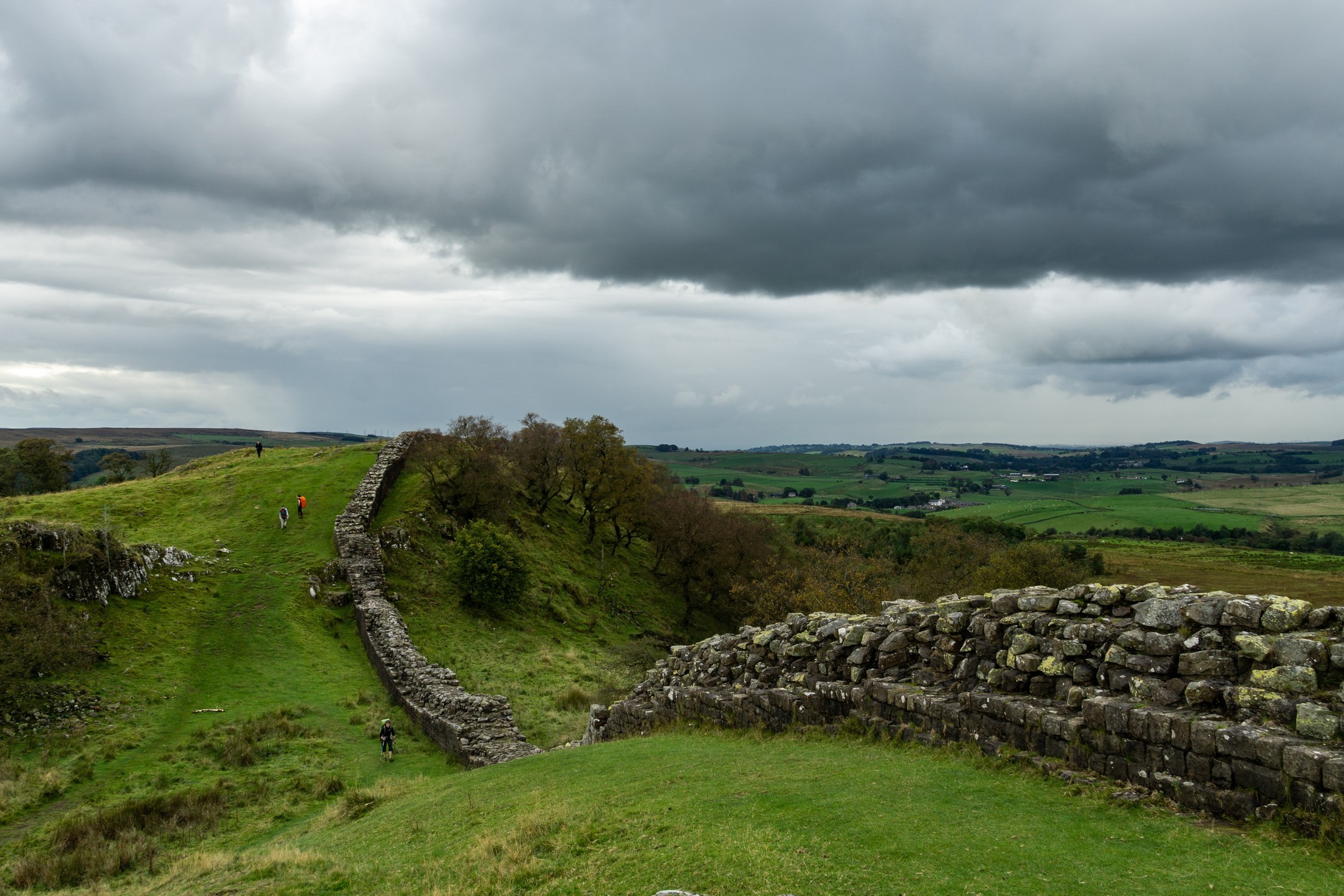
Directly after the bridge we hiked alongside what I believe is the longest unbroken stretch of wall, and we hiked up, and up. The change in terrain is pretty gradual, it sort of sneaks up on you. You go from your relatively flat walk with very few views, then as you hike the views get progressively better and better and you find yourself more frequently brandishing your camera in the general direction of the horizon, then suddenly you’re walking up a massive hill and your calf muscles are on fire.

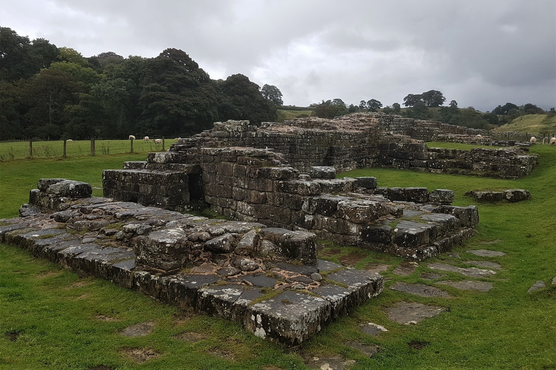
It was after Gisland where we found Milecastle 48 at Poltross Burn and settled down to shovel our packed lunch into our chops. This Milecastle is slightly different in that it was a little bit bigger than normal. It had been modified throughout the decades and barracks big enough to house a garrison of 30 soldiers were added. Can you imagine being the unfortunate sent to buggers guard Hadrian’s Wall though? Of all of the land that the Romans had claimed, beautiful, sunny, Mediterranean places, and you get posted to the bloody north of bloody England where you’re under constant attack from the Picts and the weather. Poor buggers.
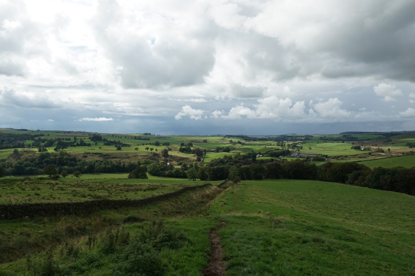
We hiked though some gorgeous, albeit damp countryside for a while after lunch. It’s a little bit wilder once you get to here, very different to the roads, towns and villages of the first two days. There also seemed to be a lot more cows. Like, a significant quantity of extra bovine and they all seemed to enjoy congregating exactly where we needed to be like bang on the trail in front of a gate or a stile. I tended to send Tarrant on ahead when this happened whilst I stared intently at the floor and hoped that if I couldn’t see the cows, they couldn’t see me.
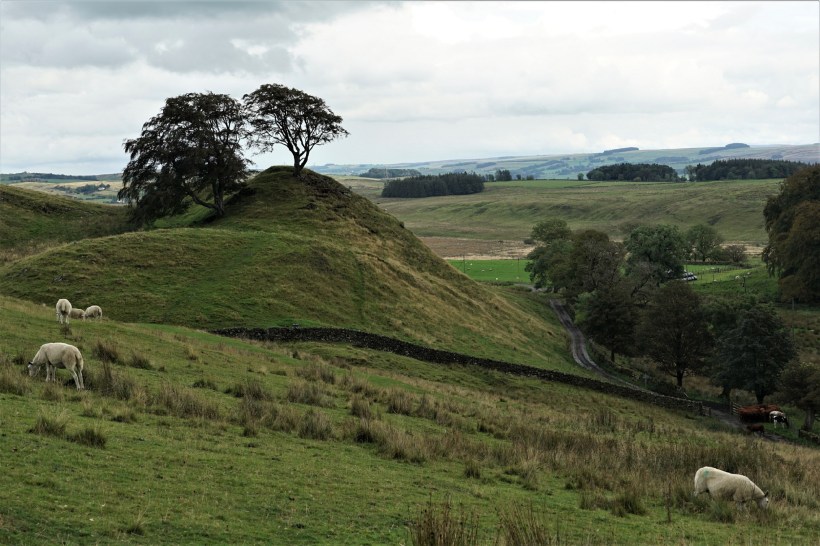
Once we were past Walltown National Park Centre though (There’s an actual toilet here by the way, if danger-pissing behind a bush isn’t really your thing), that’s when shit started to get real. Walltown Crags are just utterly, utterly beautiful. They’re just hills and hills and hills, with cliff faces dropping off into a stunner of a valley, and the wall tracing a line along the edge. How in hell did they get all that stone up all these bastard hills? We only had about 15kgs each and we were very, very aware of our knees by this point. It wasn’t as hard as it looked to be fair but I think that had a lot to do with all the stopping and marvelling we did.
A fun game we liked to play as we traversed the crags and stopped again to take yet another panoramic photograph was, “Will we outrun those massive rain clouds or will we need to charter a kayak for the rest of the hike?” We’d been so lucky to stay ahead of the weather these three days, managing to be inside when the worst of it had hit, but the clouds had been particularly black and threatening all of today. We heard rumbles off in the distance which may or may not have been thunder and we had exactly zero desire to be atop a hill, regardless of how pretty it was, during a storm. I basically have a lightning rod for a face.
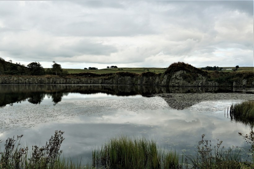
We climbed up a hill, only to climb down the hill, to climb up another hill, and repeat for what seemed like the rest of our lives. We hiked past Cawfields Lake (there’s another actually real and not a bush that may or may not be big enough to conceal your vast arse from passers by toilet here) where the sky started to tentatively experiment with rainfall again. We kitted up in our waterproofs because it kind of looked like it meant it this time and continued onwards to climb up and down some more hills. The hills stretched off into the distance as far as we could see, we checked the map and tried to gauge how many more we’d have to tackle before we veered off at Shield on the Wall and walked the last ¾ of a mile to the aptly named Hadrian’s Wall Camping & Caravan Site. Probably two. Or three. Oh fuck knows, we just wanted to make it before it got dark and my will to tear another step from my abused legs disapated into the ether and I just curled up into a small ball and whimpered a bit.
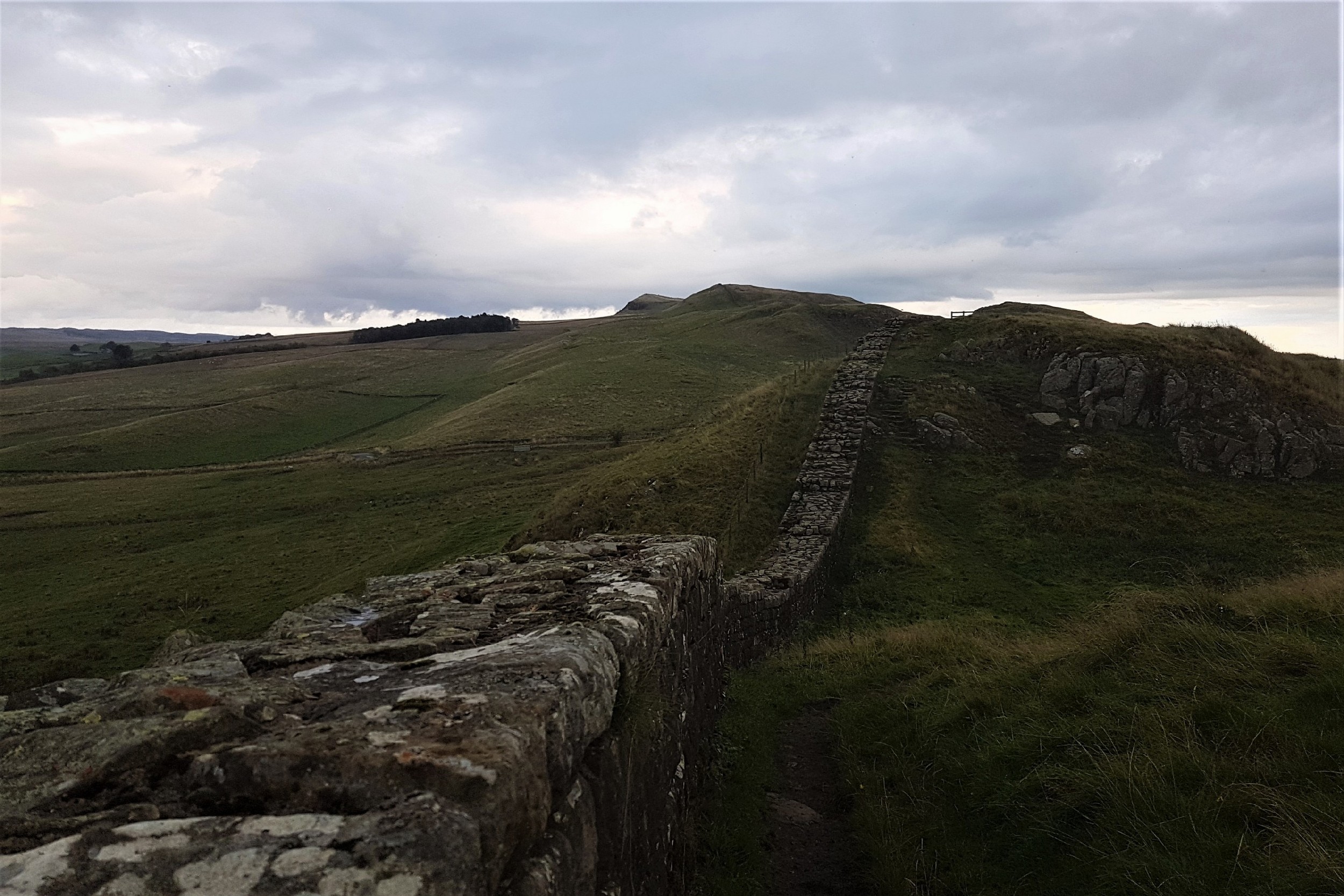
Finally, after we passed Turret 41a at Caw Gap we shuffled onto a small road which intersected the trail. Oh thank the deities! I was starting to think Shield on the Wall was a myth. We took a quick selfie at the National Trust Omega so we knew exactly where to rejoin the trail tomorrow and slogged our way cross country to the campsite. Fuck me, that was a long day. A long, hard day, and we were utterly bollocksed. But it was amazing, and educational, and it was the right kind of knackering where all of your cells feel like they’re about to die but it’s okay because you achieved something. Okay, I may have questioned every single one of my life (and holiday) choices at a couple of points, but it was basically just awesome, and if you’ll excuse me, I fully intended to shower, apply a Summit to Eat backpacker meal to my facehole, then collapse and drool profusely into my inflatable pillow.

Walton, Cumbria to Shield on the Wall, Northumberland England
Stayed at: Hadrian’s Wall Camping & Caravan Site
Activity: Walking the Hadrian’s Wall Path from west to east.
Useful shit to know…
- We can very highly recommend Florries On The Wall Bunkhouse in Walton. It’s right on the trail. We paid £25 each for a bed in a four bed dorm. They have no cooking facilities so we bought dinner and dessert there for £13 (we booked this when we booked our room) and we also booked a packed lunch for the following day for £5.50 each. Tarrant’s dairy intolerance was very well catered for without her having to settle for something vegan. They have a well stocked, reasonably priced bar with beer, wine and spirits. A large glass of wine was £3.30. Breakfast was included in the price and was excellent. You can have cereal, toast, and our host also cooked pankcakes with bacon.
- Birdoswald Fort is free for English Heritage members, or it’s £8.60 per human. It’s interesting but very geared towards children and if I did this again I don’t think I’d bother with it. You can get your English Heritage Passport stamp here at all hours from a box outside.
- Hadrian’s Wall Camping & Caravan Site cost us £16 for the pitch, good for two humans. We weren’t there long enough to fully appreciate it but the woman who welcomed us was lovely. There’s a laundry room and a small shop, and there’s an unlit shed with a gas stove for backpackers to use but it’s a proper, heavy gas ring which needs a proper sized pot or pan. My little titanium cup would have fallen through the gaps.
BUDGET
Day 3
Food/drinks inc. Snacks: £22 for both of us, including packed lunch from Florries.
Birdoswald Fort: £8.60 each
Souvenirs: £10
Accommodation at Hadrian’s Wall Campsite: £16 for the pitch for two
Total: £65.20 for two people; £32.60 each
