Day 3 : Fort Victoria to Grange Chine : 16 miles (inc. popping up the road to the shops for a resupply)
Camping in woods is amazing in that it’s so bloody warm. I’m a cold sleeper, in fact I’m a cold human in general and end up spending stupid money on wool because if it’s good enough for my Norwegian friends then it’s good enough for me, but when I sleep it’s like someone replaced all of my blood with liquid nitrogen. Sleeping in the woods is like being wrapped in a cosy blanket of nature and all you really have to worry about is trees falling on you or badgers trying to eat your face.
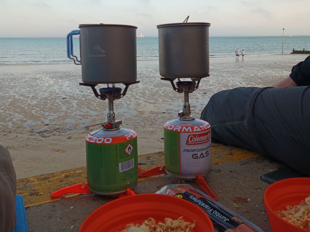
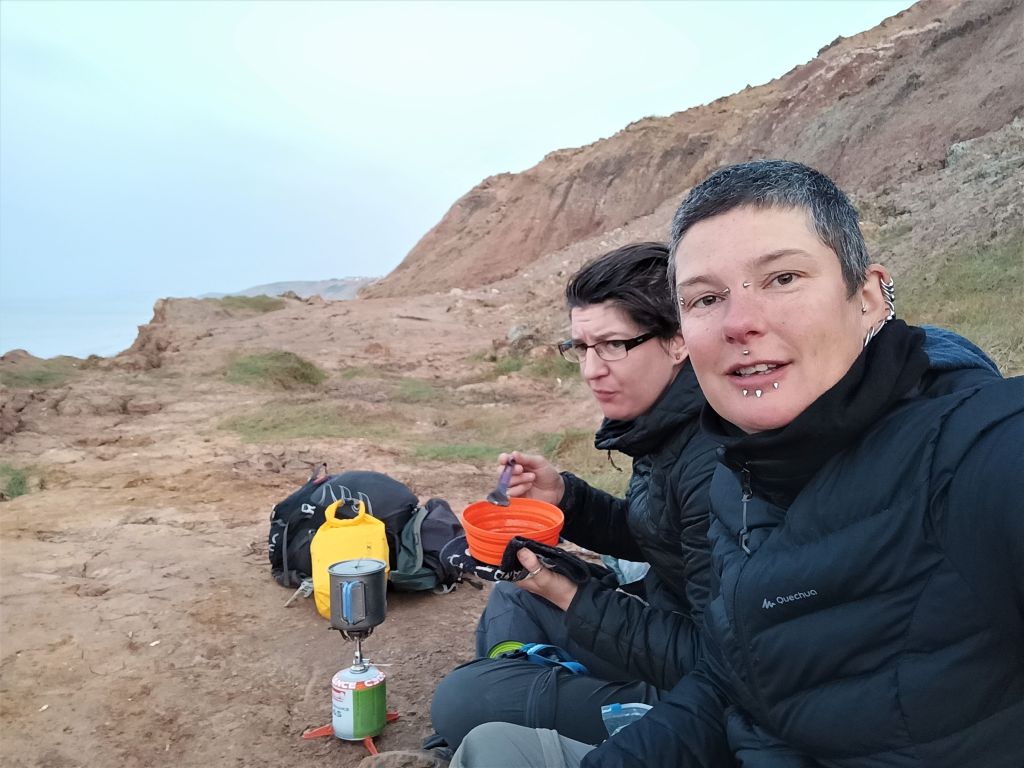
The alarm went off at 5.30am and we began the camp-breaking ritual. I have to start by deflating my gloriously comfortable Thermarest or I’m never getting out of that pit, and it always seems to take us about an hour to get our shit put away, trying to pack our respective gear without taking out each other’s eyes with elbows. We’d decided to walk down to the next beach for breakfast so I shovelled a scotch egg into my chops whilst Tarrant sorted out her knee supports because there wasn’t any way I was making it that far without my digestive system rebelling and engaging murder-mode.

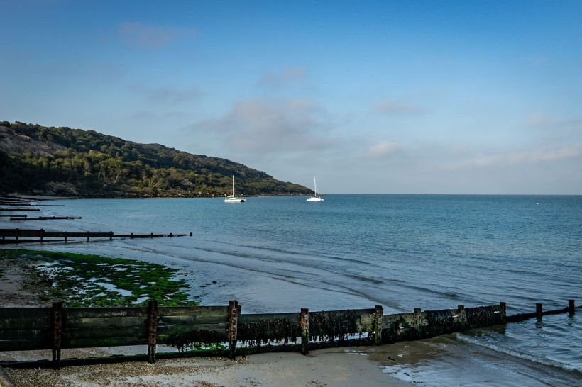
As we walked through the holiday parks we were trying so hard not to have to walk through last night we agreed that the pitch we found was probably the most perfect, what with those sunset views. We didn’t really see anywhere else appropriate as we walked through to Colwell Bay, just before Totland, which has a conveniently placed toilet with a drinking water tap outside. Excellent! Again, like the rest of this coast it seems, the tide came right up to the concrete sea wall but it was well out as we sat down, our feet dangling over the edge.
There’s a row of lovely little beach huts and a women opened up one of them right behind us. I turned to her, gave her my biggest smile and assured her we’d be out of her way soon. She was really cool though, she told us we weren’t in her way at all, she was just waiting for a friend, they were going to go swimming. I nearly choked on my frankfurter. Not a euphemism. Swimming? In the actual sea? The British sea? Is it because you don’t like having nerve endings, lady? To be fair the weather yesterday was stunning and it was lining up to be amazing again today, but the sea has to be a certain temperature before I’ll entertain thoughts of submerging myself in it and the UK just can’t seem to get it there.
We were going to try and smash out quite a few miles today on account of the fact Boris Johnson was going to make some manner of Covid-19 related announcement tomorrow and there were rumours of another lockdown. No one really knew what this would mean. Would we be talking a travel ban again? Would pubs have to close? We couldn’t see a Tory government wanting to further shaft the economy when there were still so many more commoners they could sacrifice, but if we did have to leave the island on Wednesday we wanted to have completed as much of the walk as possible. I have near-constant anxiety and it was quite likely my little brain was blowing everything out of proportion but I hated the idea of not being able to get this shit completed.
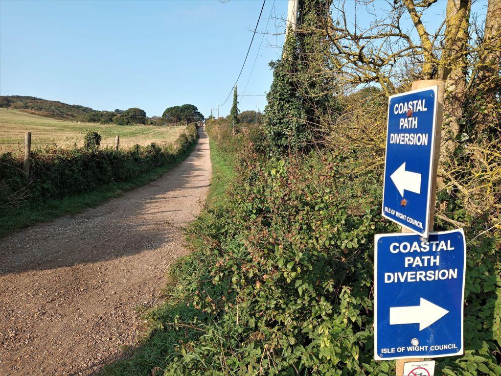
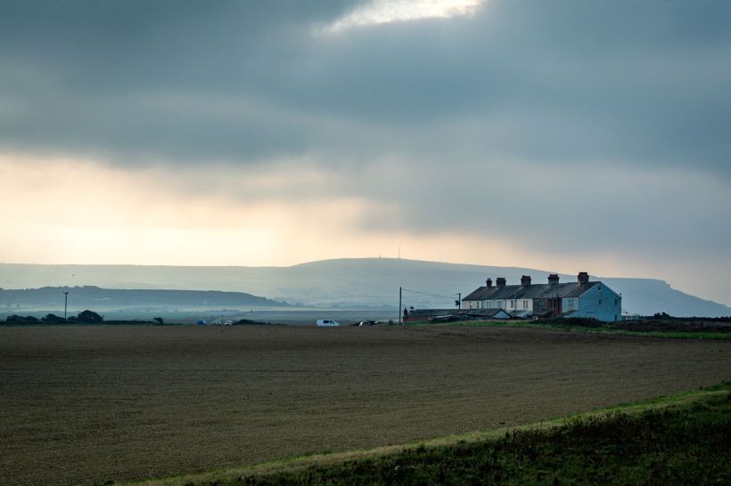
Once we’d shovelled rehydrated carbs and meat of dubious origins into our faceholes we packed up and headed west along the seafront. It was gorgeous, I love early morning light, and the wooden groynes stretching into the low tide with a couple of sailboats thrown in for good measure made for some decent eyehole fodder as our feet pounded the concrete, hoping we’d be off it soon and onto some trails. Just after an old lightboat house we swung left and climbed up some steps to walk through a residential area. The actual trail out of the built up area was closed but a detour was clearly marked so we took that to Headen Warren where the landscape suddenly became very Dartmoor-esqe, with ferns and gorse bushes stretching out to either side.
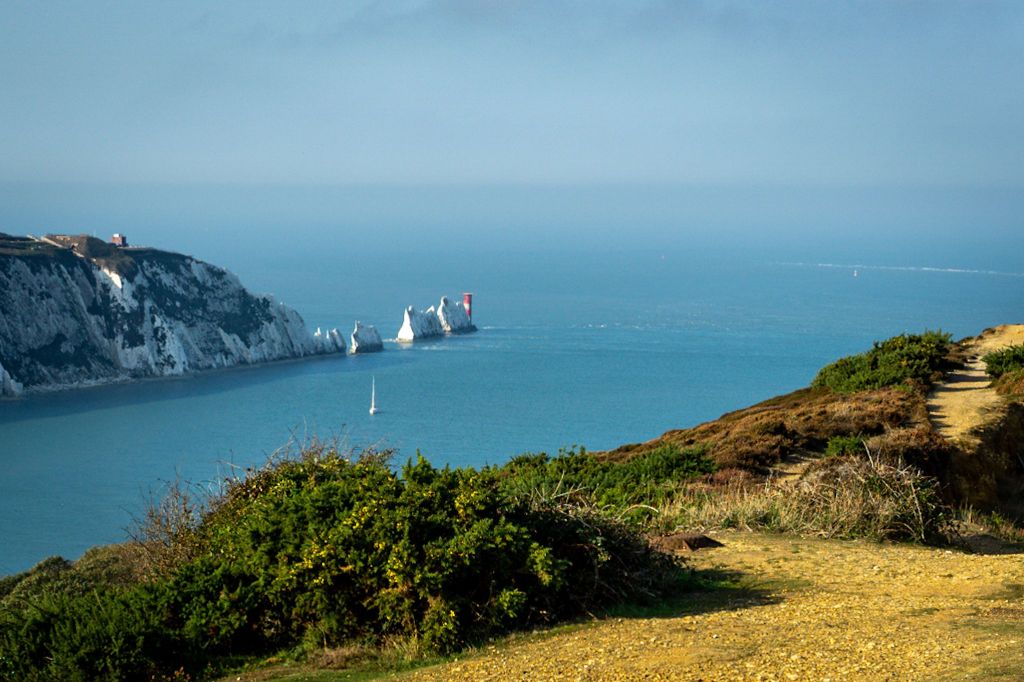
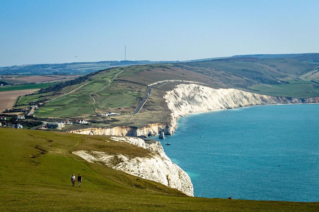
Seriously Isle of Wight, how did I not know you were this beautiful? It was only day three and I was already blown away by how varied the landscape had been. We’d gone from urban, to woodland, to causeways over fingers of rivers and estuaries. We’d walked along shingle beaches and concrete esplanades, some lined with beach huts and families holidaying in the sunshine, some just a bit more chilled with locals walking their dogs. Now, as the bushes to either side of us gradually thinned out, we were treated to a spectacular view of The Needles, a small, chalky rock formation at the far-west tip of the island. We stopped for a short while to admire the landscape whilst trying not to freeze to death in the wind.
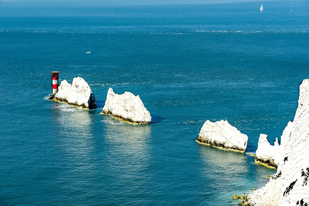
Turns out there’s a horrifically commercial attraction at The Needles once you descend because there’s nothing like enhancing a place of outstanding natural beauty with a bloody funfair. There are other things there you can throw money at, but whilst most of it was still shut up at the hour we chose to shuffle in at, they did have a café open selling tea and coffee which was definitely something we were happy to dedicate a small portion of our bank account too. Okay, maybe they were slightly forgiven for this monstrosity. You can also take a chair lift down to sea level and take a scenic boat ride to The Needles which would actually be something we’d like to do but we earmarked it for a return trip. We didn’t think we’d have the time today.
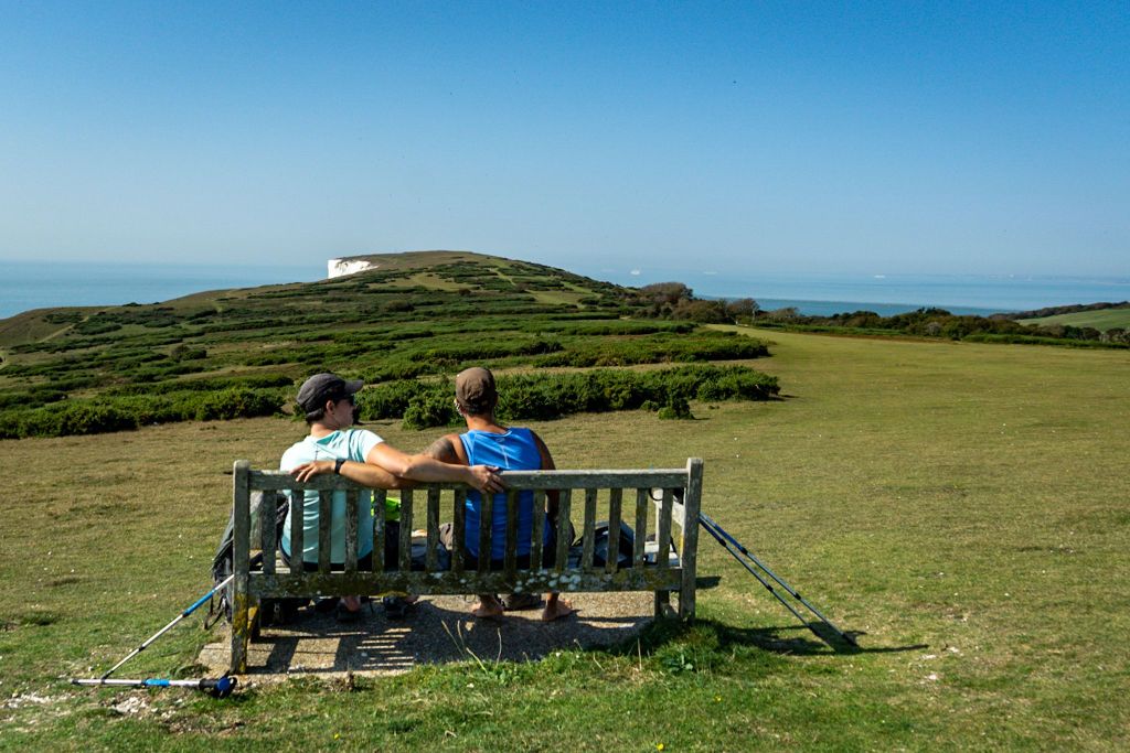
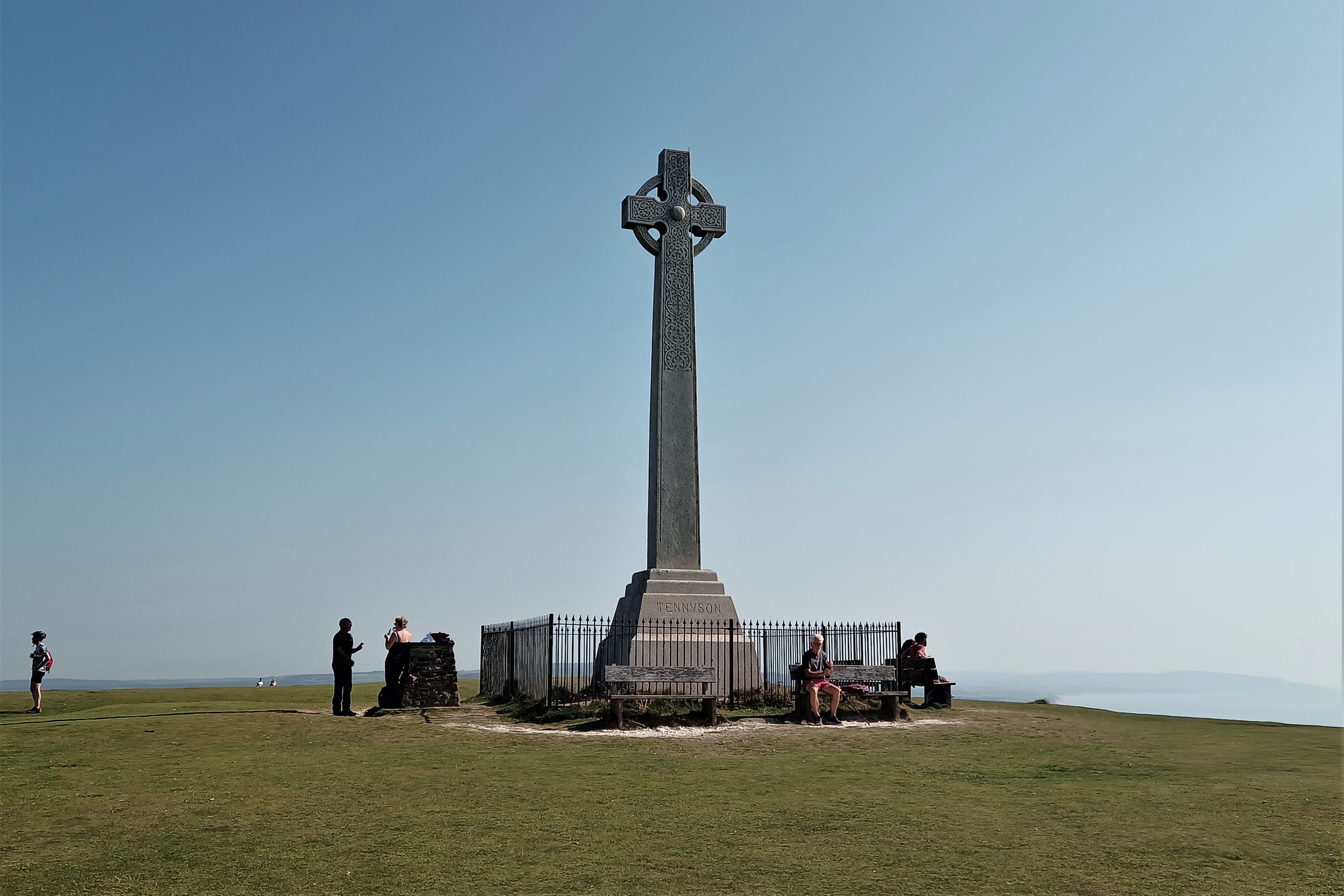
It’s an easy climb to a National Trust property once you leave the attraction where you can check out a gorgeous viewpoint and an old rocket testing station before doubling back on yourself on the other side of the peninsula to climb slowly up to the Tennyson Monument and bugger me backwards, these views! They just don’t give up! We were onto grassland now with views of the cliffs stretching off into the distance; a striking bright white at first, fading quickly into brown past Freshwater Bay. The wonder is soon replaced with the realisation though that you need to drag yourself and your backpack up and down those gloriously gorgeous hills. Good job we live for this shit hey? Nothing like upsetting your entire lower body to remind yourself you’re alive.
Once into Freshwater we stopped at some toilets where I left Tarrant and the bags to pop to a local shop to pick up supplies for the next 24 hours. As much as we like to shop as locally as we can when we travel anywhere, local shops just don’t have the same variety and choice that the chain supermarkets have. I scraped together whatever I could and headed back to the mrs.
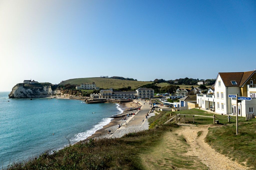
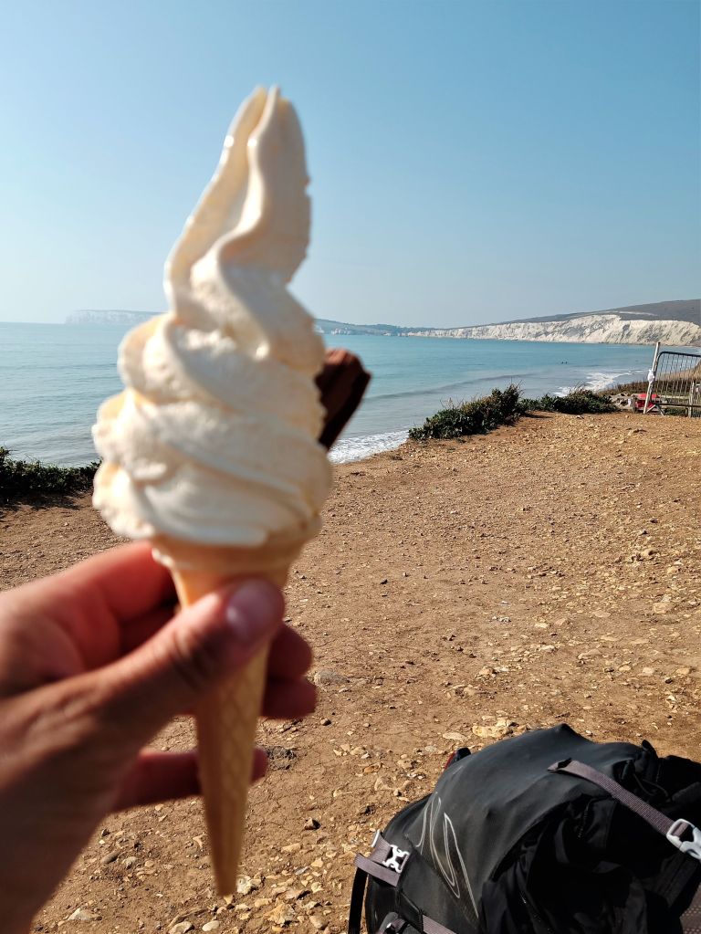
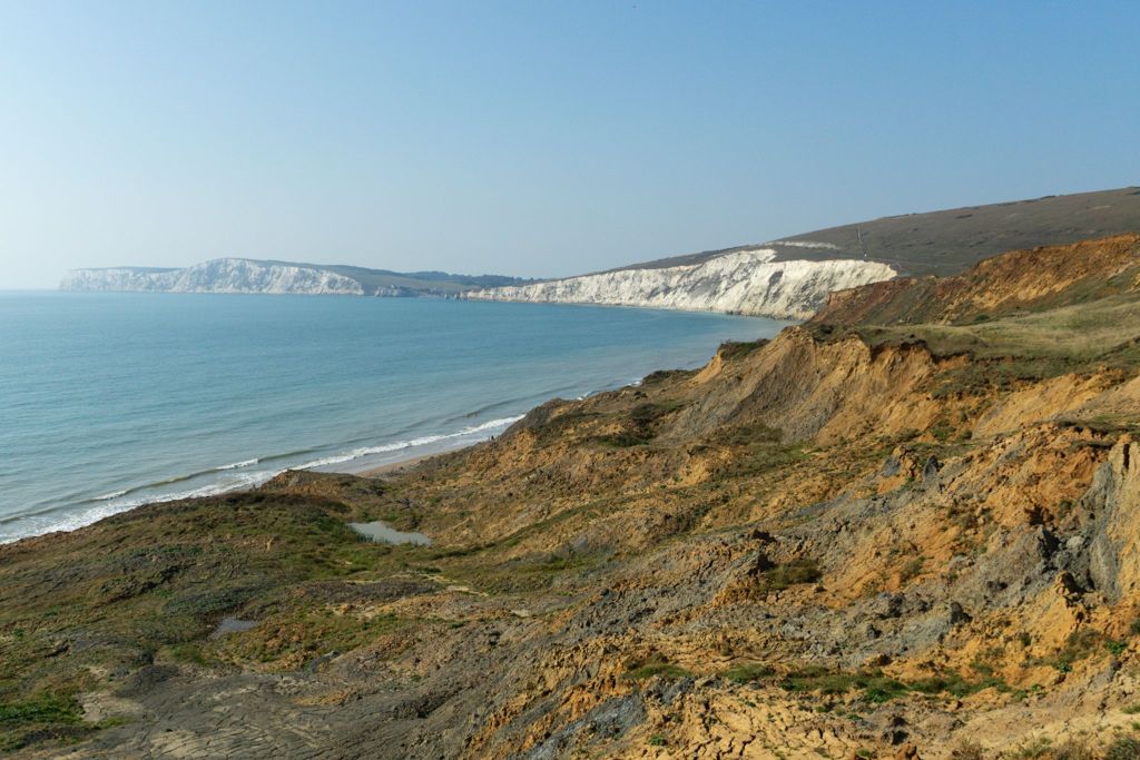
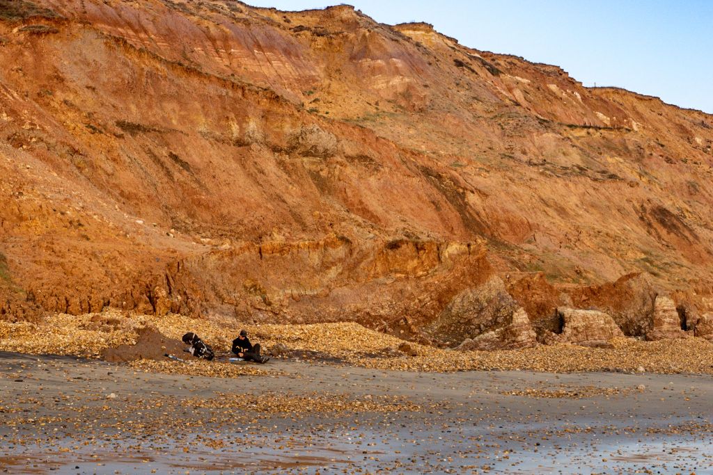
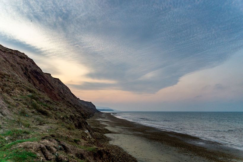
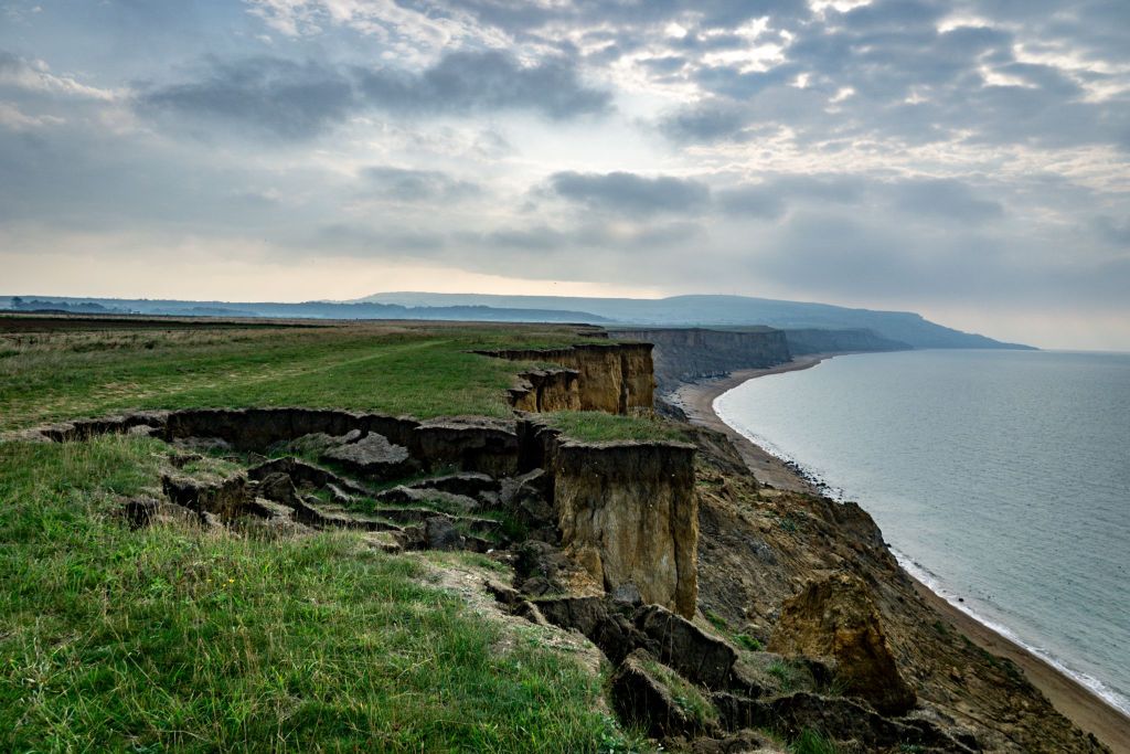
Freshwater Bay itself is absolutely lovely and it would have been nice to chill there for a bit but my anxiety about tomorrow’s announcement was still weighing on me so we pushed on through up the hill back to the cliff tops. Once you’re past the white cliffs and above the brown ones the reason for the colour change becomes really quite obvious; the whole bloody island is slowly sliding in quite a spectacular fashion into the sea. It all seemed pretty solid right now, it was dry, but I think it’s clay and it seems to come loose when wet and turn to mush. There are dried pools of a darker soil too, it looks like cooled lava (obviously it’s not), it’s stunning and a little bit scary all at the same time. We spied a few places that might have been good for a wild camp but decided to press on, though it doesn’t matter how much of a rush you’re in, it’s considered high treason in the UK to walk past an ice cream van when the weather is as hot as it was today. Hanover Point has a place to procure frozen goodness so we did just that. Got to do what we can to help revive the economy right, guys?
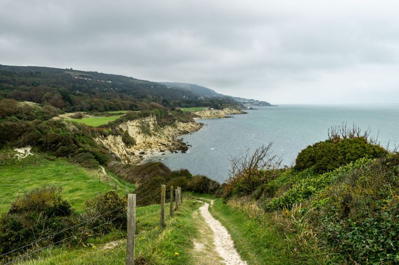
The path along the cliffs veers terrifyingly close to the edge, especially when you have the balance of a three legged giraffe on ketamine. Some of it has, well, it’s just gone. It’s not there anymore. It buggered off down the landslip along with the bit of clifftop it was worn into. These points have been rerouted through campsites and holiday parks which have seen better days. One of the parks had these concrete boxes with dirty curtains hanging in rotting windows, trees and weeds growing over the doors. I mean, fair enough, you probably couldn’t ethically rent out units that could end up in the sea at any given moment, they were very close to what was now the edge. We passed through to the other side and glanced over the cliff. Sure enough, there was half of one of these units nestled there, obviously a victim of a previous landslide. Maybe that’s what makes this area so sparsely populated compared to the busier, more built up northern coast; it’s mostly farmland, the cliffs make beach access difficult, and anything you build will probably end up several metres below in a few years time. It’s got its own wild charm though and this side of the island is most definitely my favourite.
We got as far as Grange Chine, fully intending to go further, but it was about 5pm. We were tired and it was beautiful here. Y’know what? Sod Boris and his announcement, we’d stop where we wanted to, camp where we wanted to, and if the government decided that you weren’t allowed to leave your own city for a few weeks then we’d deal with that when it happened. Most articles were pointing towards reigning in socialising, and we were intending to do the exact opposite of socialising, so I dropped my bag and left Tarrant to go and find somewhere suitable along the beach.

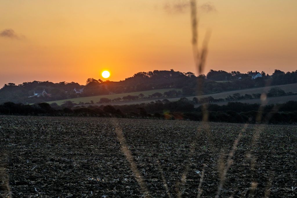
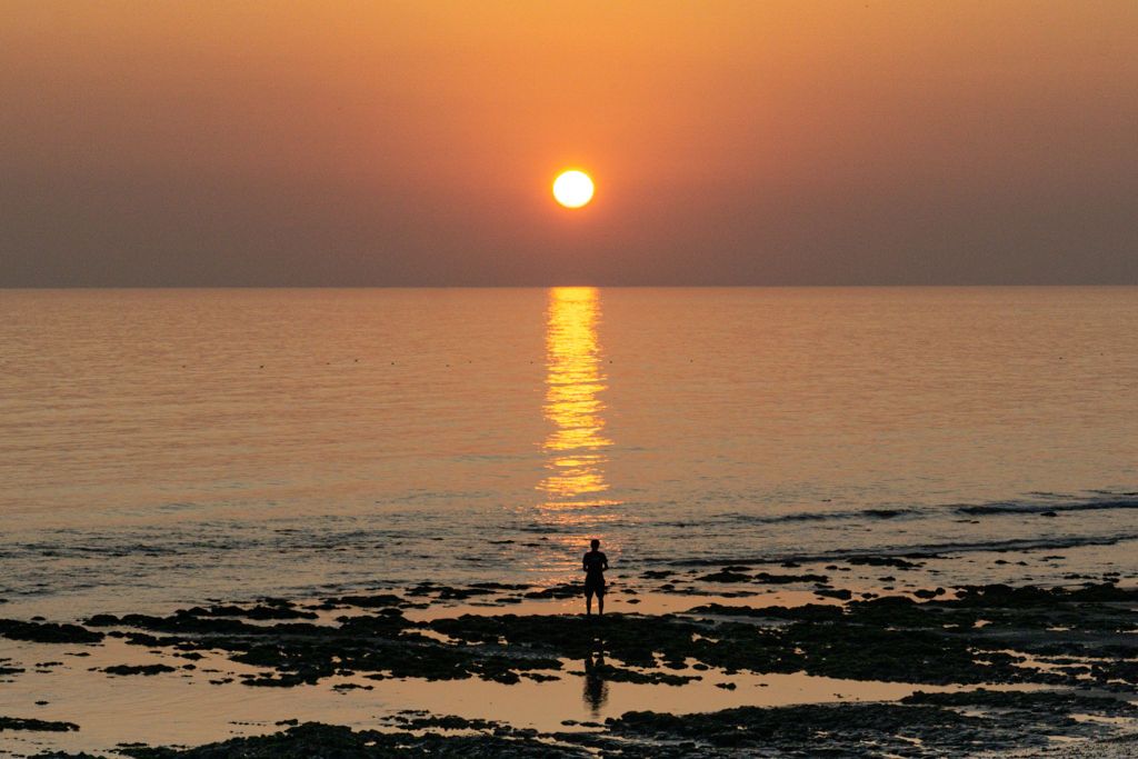
It wasn’t looking hopeful though, like everywhere else on this island the tide rolled right up to the cliff face. I noticed an easy access point up the cliffs which lead to a large, flat ledge only a couple of metres up with a fire ring. There’s definitely been a high tide since last night and the ring looked even older than that, the tide clearly didn’t come up here and there were a couple of places where we could easily fit a tent. I fetched Tarrant and we claimed our bit of beach for the evening. We’d been gagging to dip our hot, stinking feet in the sea since day one, temperatures had been reaching the mid-twenties, and tonight we finally managed it. Dinner on the beach, a couple of beers and, after the fiery skyball had exited stage right in spectacular fashion we climbed up to our ledge and pitched up for the night.
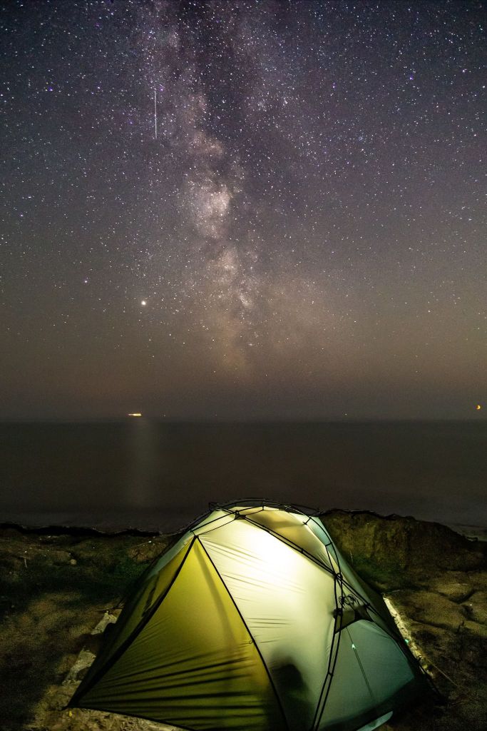
We’d been crashing out pretty early, only an hour or so after sunset, but tonight we lay on our backs next to the tent and, as the crescent moon slowly crept lower and faded into nothing behind the horizon, we watched as hundreds of thousands of stars started to appear. Satellites made their way across the night sky in straight, unblinking lines. We picked out constellations until there were too many stars and the milky way dusted a line directly above us, the sky completely clear, totally cloudless. It was definitely a bit colder tonight than it was last night, possibly because we were right by the beach and not tucked away in the woods, but we were rugged up in layers and down jackets until we eventually crawled into bed so I could lie awake worrying about landslides and high tides.
Day 4 : Grange Chine to Bonchurch : 16.1 miles (inc. wandering around Ventnor looking for toilets, a drinking water tap, the Co-op and the pub)
It was indeed bastard freezing when we woke up on the ledge this morning having not been swept away by the sea or buried under an avalanche. It was full on down jacket, gloves and snood mode as we cooked up some breakfast to warm us up from the inside before we accidentally took out a seagull with a nipple. Once we were fed we headed back to the beach access at Grange Chine, filling up our bottles at the campsite then heading up the steps and back to the cliffs. It’s actually absolutely possible to walk along the beach as long as the tide is out, there are some beach access points where you could re-join the clifftop walk should you choose to, but walking on sand and shingle is hard going at the best of times, never mind when you’re carting your home around with you, so we stuck to the top road because it’d be marginally easier on our legs and because of those sweet, sweet views.
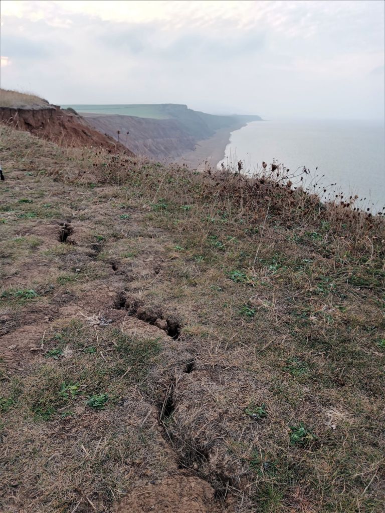
The first part of today was much like the latter part of yesterday; cliffs and landslides and large cracks along the path as chunks of earth prepared to break away any time now. We stopped frequently to gaze back over where we’d been, and as we pointed out the different colours of the different soils that made up the carnage, several large rocks broke away and tumbled down the cliff face. Oh. Fuck. Well we certainly wouldn’t be undercliff camping, like, pretty much ever again. I think we kind of knew it was a dangerous game but I’d had my little heart set on at least one beach camp, and camping on the actual beach itself wasn’t an option on account of the high tides and my general dislike of sand. Yeah, I love beaches but I hate sand. You try and work it out. I can’t and it’s my brain. But we didn’t die and we didn’t regret last night’s campsite one bit. Onwards, and it was bizarre to think that we’d be over the distant headland by the end of the day. It looks so far, but we knew we’d easily do it. Well, I say easily, tell that to my feet.
The weather was set to turn today, by the time we moved away from the cliff edge and walked down into the village of Chale where we made full use of the portaloos by the rec ground, we had complete cloud cover. As stunning as the views were we’d been staring at them for hours, the change of scenery here was welcome, and we walked through some woods where we found an ice cream van at the St Catherine’s Oratory carpark which also sold hot food and, joy of joys, hot drinks! Come to me sweet nectar of the gods! Get in my facehole! That’d prepare us for the fact we were about the ascend into a cloud.
The climb is a slow one, past Blackgang Chine which is some manner of amusement park that Tarrant remembers from when she visited the island as a child. A lot of the messages I was getting on Instagram when I posted stories throughout the day were from people who came to the Isle of Wight as a kid and had some very fond memories. Most of the local people we met were of retirement age and were doing stuff like early morning sea swims, beach camping with wine and BBQs, walking along cliff tops and generally living their best life. It seems to be that kind of place, just a really chilled out chunk of earth crust where everyone of all ages can just have a brilliant time. I think I’m a little bit in love with it.
In love with it despite the cloud we were now walking in. Are cliff edges more or less terrifying when you can’t see what’s beyond the drop? Today, it turned out, would be all about the hills. Up the hills. Down the hills. Up the bloody hills again. But with great hills come great views which take your mind off the pain in your calf muscles. To be fair though, trail fitness had set in pretty quickly and my legs were fine but I was having problems with my mutinous little toe. There was no blister, it just hurt for no discernible reason, the useless little bastard. I cut the callus off it to see if that would help. Obviously Tarrant was delighted that I decided to do this during lunch whilst she was trying to eat her sandwich. I am quite the charmer.

The trail continued with its relentless up and down with frequent stops for gawping at the scenery, then we descended into the impossibly picturesque Steephill Cove. Well now, aren’t you the stunner? The only trouble was, there was only one place open as the weather wasn’t as perfect as this tiny little bay, and it didn’t seem to have anything Tarrant could eat given the fact that anything containing dairy would make the rest of her day really rather unpleasant, and she doesn’t eat seafood because it freaks her out. To be fair, a lot of seafood does have a tendency to stare at you with its cold, dead eyes. The tide was also right in at this point so there wasn’t really anywhere comfortable to sit but fear not, Steephill Cove. One day we shall return to the island and we will be in you and I will apply all of your crabs to my facehole and I’m not sure where I’m going with this but it looks like it’s taking a turn for the weird so I’m just going to leave it there.


After the Cove it was back up the hill to come back down the hill into Ventnor where I left Tarrant so I could pop up into town to the Co-op. It was getting pretty cold now, and rain was definitely going to happen soon. We intended to walk up to the area marked on the map as The Landslip and find somewhere to camp up there but it was only a couple of miles if that, and it was still early. Only one thing to do then; pop into the Spyglass Inn for a cheeky pint. That killed just enough time, and they kindly filled our water bottles up for us too.
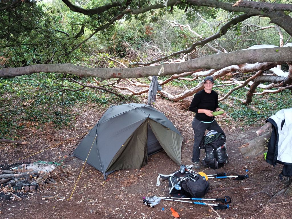
Last slog up the hill, racing the potential rain, to find somewhere to call home for the night. As soon as we were into the woods we took it in turns to follow side tracks to see where they led. Mostly they led nowhere, or where they ended up was too small for a tent, or too slopey. Until we came to one trail which went a bit deeper into the woods to a clearing with an awesome old tree and a fire ring. There was a weathered sign up asking people to enjoy themselves but to respect the area.

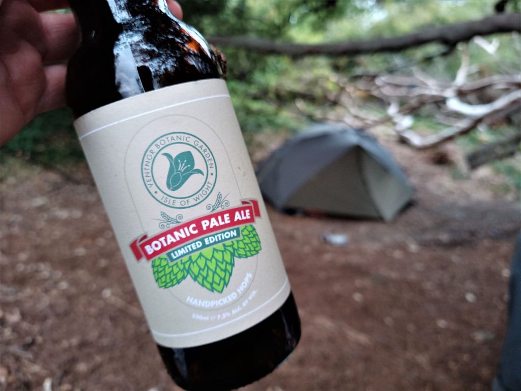
Hmm. Not much respecting going on looking at the rubbish that was left, but we’d carry that out with us. We wouldn’t use the fire ring either as tempting as that would be, we didn’t want to draw any attention to ourselves, but given the impending downpour we didn’t think anyone would be popping by for beers and a BBQ so we felt pretty safe here and pitched up straight away so we’d have somewhere to go when the heavens opened. Ooh, and we’d also swung by the Botanic Gardens as we’d heard they had their own micro brewery and I do so like a local tipple. We only bought one bottle to share though, largely because we’d have to carry that shit, and also because the pale ale is 7.5%. If you need my liver it’ll be curled up in the corner, weeping. It’s really quite nice though, not too hoppy which suited Tarrant, just a bit fruity, though I couldn’t probably only manage a couple if I wanted to function, y’know, ever again.
We watched Boris’s announcement that night, huddled in the tent. Thankfully we didn’t need to leave the island then, the restrictions were mostly placed on pubs and restaurants, plus an increased use of masks. We were good to take the rest of the walk at our own, leisurely pace which would be ideal for nipping into cafes and pubs and other places which generally had roofs in order to escape the pissing rain that was forecast for the next couple of days.

Isle of Wight, England
Stayed at: Wild camp on a ledge above the beach near Grange Chine on night three, and a wild camp in the woods on the cliffs below Bonchurch on night four.
Activity: Walking the Isle of Wight Coastal Path, anti-clockwise
Useful shit to know…
- There’s a drinking water tap at the toilets at Colwell Bay which is pretty much the first civilisation you come to after the holiday parks. The toilets just before Freshwater Bay have proper sinks unlike most of the public bogs here. You can fill up your water here, brush your teeth, have a quick wash etc. The campsites above the cliffs once you’re beyond Freshwater Bay have drinking water taps too.
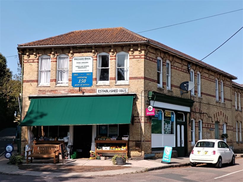
- When you get to the toilets just before Freshwater Bay, the trail goes to the right. If you turn left instead and walk for a few minutes you’ll see the local shop, called Orchard Brothers.
- There aren’t many places to access the beach once you’re on the cliffs past Freshwater Bay; there’s one just after Compton Chine, one at Hanover Point where there are also some toilets and an ice cream van, the next one is just before the Pearl Café at Chilton Chine, one at Grange Chine which is where we camped on the third night, then there’s nothing until Shepherd’s Chine nearly two and a half miles on.
- Before you get to Steephill Cove you’ll go past the Botanic Gardens. We nipped into the café to use the toilet and avail them of one of their tasty pale ales, and I believe if you want to visit the gardens you can buy a wristband from there too. It’s £9.50 per fully grown human. We didn’t visit the gardens though, we would have wanted to dedicate more time to it than we had.
- There are toilets in Steephill Cove and Ventnor, but the drinking water tap in Ventnor is currently out of use.
BUDGET
Day 3
Groceries: £3.87 each
Beers: £2.50 each
Cup of tea: £1.60
Ice cream: £2.25
Total: £10.22 per human
Day 4
Groceries: £10.77 each
Beers (Botanic Gardens, shop & pub): £11.30
Can of Coke: £1.75
Cup of tea: £1.30
Total: £25.12 per human
